Touring in Nortumberland

ProDave

Full Member
Posts
108
Likes
156
Shortly we are to set off to explore Northumberland by MH. A county we visit often as have relatives there but have never properly explored.

Looking at the PIO app very few of the POI's have any reviews, so it is hard to build up a picture of whether wild camping is tolerated there or not. And seeing as Norhumberland is Englands least densely populated county I expected it to be popular with MH's?

Any practical advice appreciated.
There is a Northumberland 'version' of the NC500, known as the "Northumberland 250".
Might be worth having a look at some Youtube videos on this and see if any of the locations takes your fancy?
I keep meaning to have a wee look at this as the route is on my doorstep!

Check out the link below (y)
 
There is a Northumberland 'version' of the NC500, known as the "Northumberland 250".
Might be worth having a look at some Youtube videos on this and see if any of the locations takes your fancy?
I keep meaning to have a wee look at this as the route is on my doorstep!

Check out the link below (y)
Thanks for that. I will first search for a map or guide describing the route in words and pictures before I spend hours watching youtube.

We were just expecting to work our way up the coast from Newcastle.

Edit. Details here https://northumberland250.com/

We are primarily going for a wedding in Corbridge. That would nicely break down into doing the inland part of the route on the way down, do the wedding, then the coastal leg on the way back.
you're welcome.
 
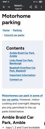
There's overnight parking allowed at several Northumberland car parks for £12 a night. Worth knowing about as a back up.Search "motorhome parking, Northumberland "
 

Attachments

  • Screenshot_20250719_160704_Chrome.jpg
    Screenshot_20250719_160704_Chrome.jpg
    162.2 KB · Views: 18
There's overnight parking allowed at several Northumberland car parks for £12 a night. Worth knowing about as a back up.Search "motorhome parking, Northumberland "
I used that scheme last month to stay at the Links Carpark in Bamburgh.
Was £12 too much and with my experience that night, I'd have to be paid to overnight there again.
 
Can someone help me out with "technology" here please.

I have the Northumberland 250 route downloaded from their web page which opens on my computer or my phone appearing as "google maps" within a browser

This is just a map with the route on it. The usual google maps features like show your location or navigate to here are missing.

Likewise if I go to google maps in the normal way where I have the usual menu options, I cannot find a way to import this route.

I want to be able to use this map in the same way as I normally use google maps to navigate the route. But I cannot work out how. I must be missing something blindingly obvious. Please help.
 
I think you can't navigate using the free map because they want you to pay £2.50 to download the GPX map.
 
So if I pay £2.50 to download that GPX map, just HOW do I input that into google maps to use it for navigation?

I am not against paying but I want to understand how it is going to work first. I cannot find yet how ti import files in google maps?
 
Why not just plot it yourself on google maps. The route is on that home screen of that link. Just find each location and add it as a stop. There are no that many. Would just take a few minutes.
 
I don't use Google maps myself, but a search revealed a number of videos on YouTube explaining how to do this.
 
We did 10 days round Nortumberland a few weeks back and just picked our next stops as we went round. First stop was Saltburn and went from there up as far as Berwick on Tweed. I will find our route out and post it later.
 
Right I have cracked this.

When I click the link to the North250 route, it opens google maps, but what I had not noticed is the window it brings up is not signed in to my google account. This is in spite of the fact if I just click the normal google maps icon on the screen that does open a signed in window.

Once I spotted this and signed in, full function returned.

What is really odd, is this is repeatable. If I close the map and re open it from the North250 link, it is again, not signed in and signing in returns full functionality.

I was not expecting googles software to be this flakey that sometimes it opens without you being signed in but it is not blindingly obvious that is the case.
 
Well we are back from our Northumberland trip. Here is a quick summary.

4 days travelling on the way down on the inland leg of the trip, with 2 nights wild camping and one night on the Kielder campsite (after traversing the Kielder forest drive.)

Then 2 days in a rented house with relatives to attend the wedding in Corbridge.

The return up the coastal leg was more relaxed with no time limits to keep to. 2 nights in Alnwick, great place to visit, then on to the coast stopped a night in Walkworth.

Then it got "interesting" this ere storm Florin was due to arrive so we checked into a Camping and caravan club site, preferring to be in the middle of a grass field than under or close to trees when the storm hit. It turned out a lot windier and lasted longer than expected to we extended that to a second night. MH's and caravans were alright but hardly a tent left standing on the site, one even took off and was last seen flying over the hedge around the site.

We then carried on up the coast, continuing up the east coast of Scotland for another couple of nights.

And then finally to break the return trip up the A9 had a night stop at Ranoch Station, I like visiting remote "end of the road" places.

850 miles in total weather generally good apart from the storm and everything worked.

Regarding navigation. Google maps did it's job reasonably well but it also showed it's limitation. It has severe limitations with it's database of minor roads, for example driving the southern side of Loch Ranoch, it showed no road to be present and showed us driving along in the water at the edge of the loch.

The choice of some of the roads used for the North 250 is questionable, some very narrow twisty roads in one section that may challenge some, made even more interesting when we came to a closed road and had to make our own diversion which took us down an even more interesting road.

So while google maps has it's uses, you cannot beat an up to date large format road atlas.
 
Back
Top