Ggohd
Full Member
- Posts
- 52
- Likes
- 34
I have used ms autoroute for years as a planning aid and visual display for POIs since about 2006. Currently running 2010 unfortunatley on Win 10, coz that's what they force you to have now.
All of a sudden it's stopped working, tells me a cd drive can't be accessed, as it ran from my hard drive don't see why it should matter. Anyway, it suggests a reload from the cd, did that , same result.
Have Microsoft fed in a bug, trying to drive us onto online services?. Well, most of the places I go you can't get online readily and there is no way to a view a map with imported POIs displayed.
Of course I have all my POIs on the gps, but the display is totally useless for planning purposes and the links in the POIs don't work either.
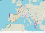
I wonder if anyone knows of a mapping program, covering Europe, which allows the import of POIs and which could replace autoroute.
All very well to look at aire, gas and other locations on a phone, but a wifi connection is needed, so sitting in a remote spot planning tomorrows route has become much harder.
I've tried using the Garmin software, Basecamp, found it lumpy, hangs a lot and not a patch on Autoroute for display of POIs
Any IT specialists out there have any ideas??


