Finding locations on a route?

alwaysared

Full Member
Posts
1,447
Likes
1,820
As per the title, is it possible to plan a route in the app and see what locations are along or near it?

Regards,
Del
 
Yes the WC app, I'm sorry but I just assumed that because it was in the WC App forum that people would know it was the WC app :(

Regards,
Del
 
I'd just got up ****!!

God you lot don't half go on :rolleyes: :rolleyes:
34526903-B130-4211-B7E7-39BEEE3B2FBC.jpeg


All I’m saying 😉😁
 
As per the title, is it possible to plan a route in the app and see what locations are along or near it?

Regards,
Del
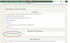
Yes and No, Not in the actual app as far as I can see, but since I'm up early and refusing to do any work I've been having a play and Yes there is a way.

Go to poi downloads and download the wildcamping zip file
Screen Shot 2023-03-28 at 04.58.35.png

Open the downloaded wildcamping.kml

Screen Shot 2023-03-28 at 05.01.42.png
(I'm on mac so it will appear differently on PC)

That should open Google earth.

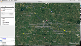
Screen Shot 2023-03-28 at 05.05.26.png

Now you can plan routes that show the poi's.

Once your done you can export that to Garmin of TomTom.

Now be nice and bring me a large mug of tea and maybe some toast..
 
If travelling it's difficult to know how far we will get before feeling tired. So we tend to stop about 3.00. Find some POIs on our route, an hour or two ahead and plot sat nav. Usually do plan A,B and C.
This works really well abroad too (using other brands of app too!)
 
If travelling it's difficult to know how far we will get before feeling tired. So we tend to stop about 3.00. Find some POIs on our route, an hour or two ahead and plot sat nav. Usually do plan A,B and C.
This works really well abroad too (using other brands of app too!)
When abroad and in UK, we look for likely stops the evening before [often picking an 'either/or' pair of locations in case the aire is full or not what we expected] within our preferred driving mileage. And if it is a tidy distance, we break the habit of a lifetime and get up early [but still manage to set off late ...]. I can't get the hang of this 'prevaricate now' routine ... :rolleyes:

So Scotland to Newhaven would involve a first night stop at Moffat [now changed to Congleton after a snotty reception at Moffat in September]; overnight in West Midlands [pub stop or A491 Layby at Hagley]; and then Newhaven Ferry Port, around 180-190 miles each day, allowing arrival early enough for a wee wander to stretch the legs and relax before tomorrow's 'and repeat yesterday' routine. All very low tech after switching on the SatNav!

Steve
 
Maybe best to import the poi into organic maps and use that to navigate.
Pois should show on the route.
Sorry cannot test it fully but looks ok for a few poi here in thailand,
Once you have one in mind just set itas the destination !
 
I;ve come to the conclusion that the answer to my original question is no :unsure: Like Boris7 has pointed out there are work arounds, I've been importing them into my Garmin Camper from the POI downloads, planning the route in Google then converting it to a GPX file and uploading it to the Garmin then they appear as I drive along the route. I just thought there maybe a way to plan a route in the app so I would see them before I uploaded it to the Garmin. Thank you for all the replies and suggestions, especially Boris7 which could be an alternative to my current ball ache method.

Regards,
Del
 

Users who viewed this discussion (Total:0)

Back
Top